O'Neil Alley Hump Cut

20090914 cp 0404
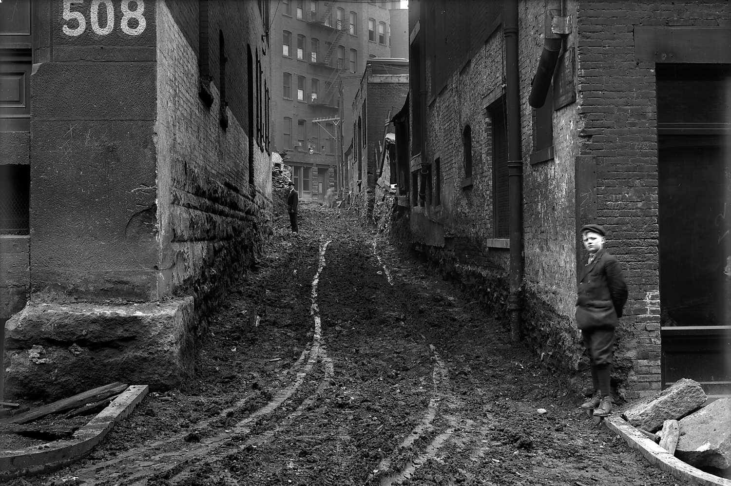
View of construction along O'Neil Alley during the hump removal project, looking from Strawberry Way to Dante Alley. The "hump" cut took place in the downtown area known as Grant's Hill. The project began with planning in 1909 and ended with the final cut in 1913. It changed the gradient of Grant Street, Diamond Street, and Oliver, Fifth, Sixth, Webster and Wylie Avenues. Please see Frederick Law Olmstead, Pittsburgh Main Thoroughfares and the Down Town District: http://digital.library.pitt.edu/cgi-bin/t/text/text-idx?c=pitttext&view=toc&idno=00aep1324m for more information.
April 3rd, 1913
Location
Downtown
Address
O'Neil Alley
Pittsburgh City Photographer Collection
More Details
Source
Pittsburgh City Photographer Collection, 1901-2002, AIS.1971.05, Archives Service Center, University of Pittsburgh Original URL
Subjects
Streets--Pennsylvania--Pittsburgh--Maintenance and repair.; Commercial buildings--Pennsylvania--Pittsburgh.; Pedestrians--Pennsylvania--Pittsburgh.; O'Neil Alley (Pittsburgh, Pa.).; Downtown (Pittsburgh, Pa.).
Identifier
715.133286.CP
Rights
Public Domain - Anybody may use this photo for any purpose
Nearby Photos
Small 131278cp
Lemon Alley
Small 000375pic
Pittsburgh Policeman in Street
Center Marker
Loading...
Start by dragging the marker to where the photo was taken from
Oops, there no search results. Try searching again or pressing Center Marker
Oops, there is no Street View image for this spot. That's OK though, the map is more important
Tags
Comments
    Log in to leave a comment