Hump District

20090728 cp 0325
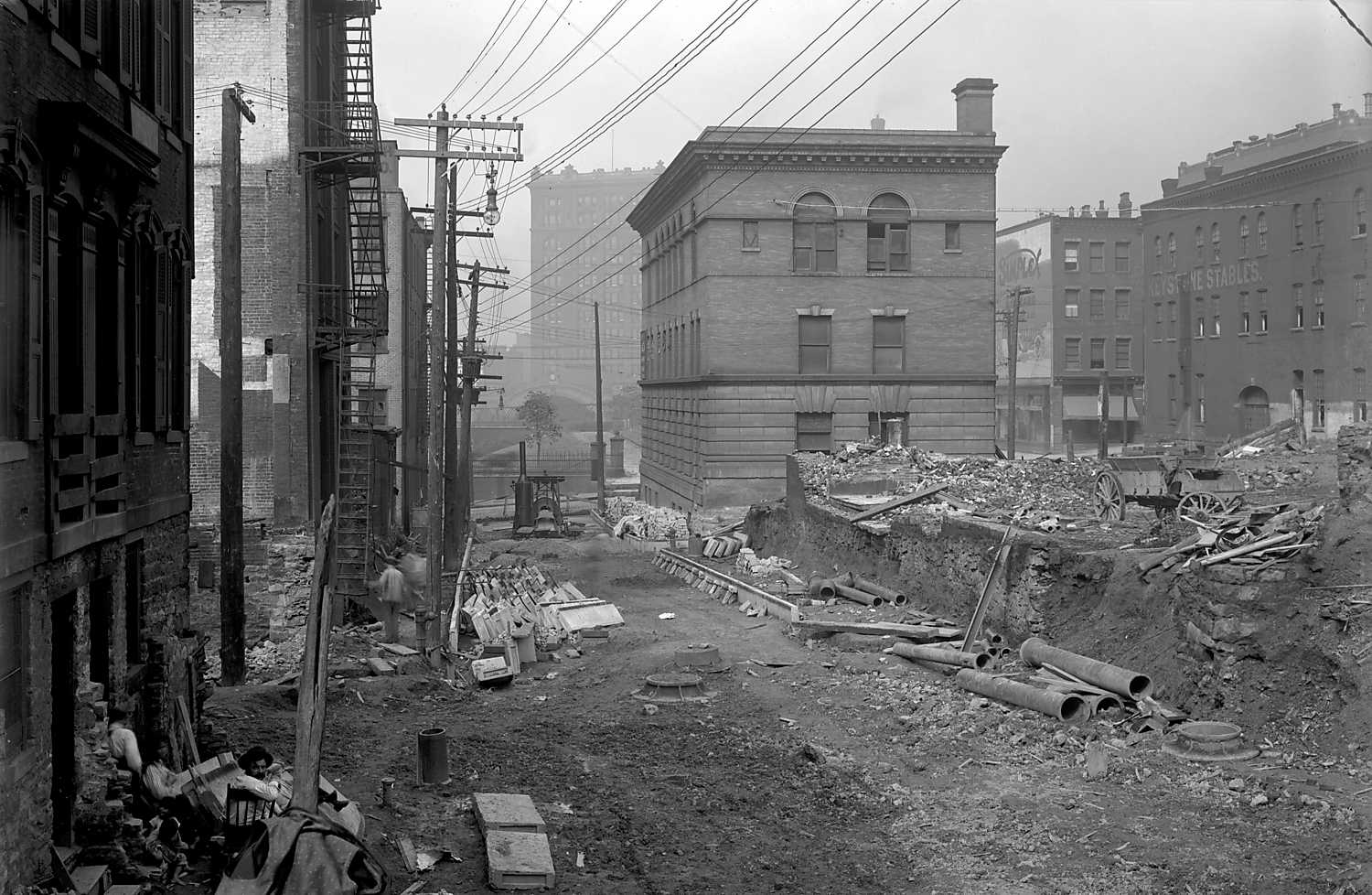
View of the Hump District on Pentland Street from Dante Alley to Seventh Avenue. During the 1900s, the "hump" cut took place in the area of downtown known as Grant's Hill. The project began with planning in 1909 and ended with the final cut in 1913. It changed the gradient of Grant Street, Diamond Street, and Oliver, Fifth, Sixth, Webster and Wylie Avenues. Please see, Frederick Law Olmstead, Pittsburgh Main Thoroughfares and the Down Town District: http://digital.library.pitt.edu/cgi-bin/t/text/text-idx?c=pitttext&view=toc&idno=00aep1324m for more information.
September 6th, 1912
Location
Downtown
Address
Pentland Street
Pittsburgh City Photographer Collection
More Details
Source
Pittsburgh City Photographer Collection, 1901-2002, AIS.1971.05, Archives Service Center, University of Pittsburgh Original URL
Subjects
Streets--Pennsylvania--Pittsburgh--Maintenance and repair.; Commercial buildings--Pennsylvania--Pittsburgh.; Blue collar workers--Pennsylvania--Pittsburgh.; Wrecking--Pennsylvania--Pittsburgh.; Horse-drawn vehicles--Pennsylvania--Pittsburgh.; Pentland Street (Pittsburgh, Pa.).; Downtown (Pittsburgh, Pa.).
Identifier
715.122845.CP
Rights
Public Domain - Anybody may use this photo for any purpose
Nearby Photos
Small 20100824 hpicasc 0044
Grant Boulevard [Bigelow Boulevard] Plans
Small 20090728 cp 0132
Hump District
Center Marker
Loading...
Start by dragging the marker to where the photo was taken from
Oops, there no search results. Try searching again or pressing Center Marker
Oops, there is no Street View image for this spot. That's OK though, the map is more important
Tags
Comments
    Log in to leave a comment