
"Now the Cambria Hotel Parking garage next to PPG Paints Arena"

"Railroad Bridge near Allegheny RiverTrail Park seen in background."
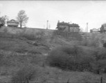
"Home on the right is at Dunlap Street and Ruggles on the northeast corner"

"This tunnel was closed off in February of 2024."

"The "now" photo is the incorrect section of the 30th Street steps. It shows the section above Bigelow. The "then" photo shows the section below Bigelow down to Paulowna."

"I want the streetview to look more to the right but when I try to fix it it doesn't change."
"I want the streetview to look more to the right but when I try to fix it it doesn't change."

"I'm having trouble pointing the view a bit more to the right"

"This photo is taken from the vicinity of the Isaly's Dairy building on Blvd of the Allies, looking down on 376, with (right to left) Mackey St, Hodge St, and (barely) Bates St visible in the foreground"

"The Endness Street steps are visible if you look directly above the man standing near Saw Mill Run. These were wood then, but were replaced by concrete steps in the late '40s. They are (mostly) still there in 2023."

"Just went down these steps today. (They're closed but I was able to make it all the way thanks to a board someone put in.) They are concrete now and are in rough condition. The "now" photo is what you see across Kilbourne St. when you get to the bottom."

"These steps are called St. Michael Street, presumably named after St. Michael's Church at the bottom."

"omg it does say that.
Please ignore me. "
"I believe this photo should say "looking North." From the vantage of this photo, if we were facing West, there would be no bridge in the background. "

"Directly next door to this site today (4331 Andover Terrace) is a split-level home built by Robert Lavelle, a prominent Black realtor in Pittsburgh beginning in the 1950s. Lavelle did a great deal to advance opportunities for home ownership for Black Pittsburghers when white-owned banks and realtors would not sell them homes."

"This movie theater was the big thing for a lot of Bloomfield residents. In my era the late 1970’s throughout the 1980’s & into the low 1990’s was so much fun. My good friends and I would visit this theater on many a Friday or Saturday night and see all the latest films. Also above the movie theater was a few classrooms 4th & 5th grades from the Church & grade school Immaculate Conception. I believe the door on the right on the bottom picture was where we would exit the building once our school day was over. It was either or door not sure really . It was a long time ago. lol 40+ years. "


